Siglufjörður
Siglufjörður is a small fishing town in a narrow fjord with the same name on the northern coast of Iceland.
The population in 2011 was 1,206; the town has been shrinking in size since the 1950s when the town reached its peak of 3,000 inhabitants.
The municipalities of Ólafsfjörður and Siglufjörður, connected since 2010 by the Héðinsfjörður Tunnels, merged in 2006 to form a municipality called Fjallabyggð, which literally means Mountain Settlement.
Siglufjörður is the site of The Herring Era Museum, a maritime museum which opened in 1994.
The town grew up around the herring industry that was very strong in the 1940s and 1950s. The first Icelandic Municipal Savings Bank was founded in Siglufjörður in 1873, and on 22 October 1918 Siglufjörður attained municipal status (kaupstaðurréttindi) with the rights and privileges of a town. The number of inhabitants amounted to 146 in 1901 and to 415 in 1910, to 1,159 in 1920, to 2,022 in 1930, to 2,884 in 1940, to 3,015 in 1950, to 2,860 in 1960, to 2,161 in 1970 and to 2,047 in 1979. In 1989 Siglufjörður had 1,806 inhabitants. Herring fishing declined considerably after 1970, and the herring processing plants were closed. Many people left the area. Today the town remains dependent on fishing industries. The government of Iceland is attempting to reverse the population shrinking in the area by improving land transportation and by promoting tourism. Today herring fishing is no longer productive in the region.
Map - Siglufjörður
Map
Country - Iceland
 |
 |
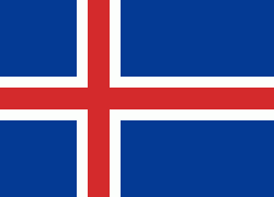
| Flag of Iceland | |
According to the ancient manuscript Landnámabók, the settlement of Iceland began in 874 AD when the Norwegian chieftain Ingólfr Arnarson became the first permanent settler on the island. In the following centuries, Norwegians, and to a lesser extent other Scandinavians, immigrated to Iceland, bringing with them thralls (i.e., slaves or serfs) of Gaelic origin.
Currency / Language
| ISO | Currency | Symbol | Significant figures |
|---|---|---|---|
| ISK | Icelandic króna | kr | 0 |
| ISO | Language |
|---|---|
| DA | Danish language |
| EN | English language |
| DE | German language |
| IS | Icelandic language |
| NO | Norwegian language |
| SV | Swedish language |


